Distance Measuring In The Field: A Beginner's Guide


Though firearm technology continues to advance, it will always run up against the realities of physics. And as long as gravity exists, it will continue to pull bullets to the ground at a constant rate. The horizontal distance to the target is the most precise way to adjust for that drop, so learning how to range targets is a critical skill for shooters to master.
Guides @ TFB:
- How to Clean Your AR-15: A Complete Guide
- The Top 5 Best Rifles & Long Guns of 2024
- Concealed Carry Corner: Carry Gun Size Guide
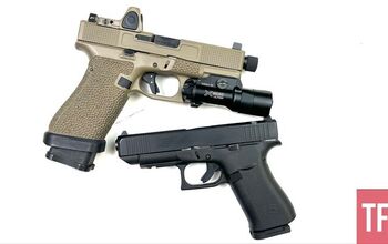
- The 5 Best Full-Size Handguns
- Best AR Pistols
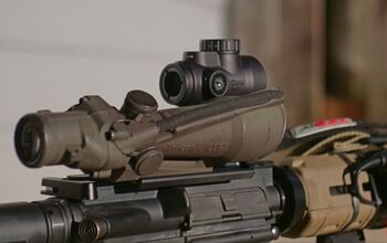
Laser Rangefinder
This is clearly the easy answer. Laser rangefinders (LRFs) have become an easy item to find on store shelves, and the prices are very good. Once upon a time, this was not the case. I used one of the early Simmons laser range finders when I was a kid, and it was very unimpressive. It struggled to range reflective targets past about 300 yards.
In contrast, the current great laser range finders can hit 2000 or 3000 yards consistently. Many include features like onboard ballistic calculators to give accurate drop corrections along with the range info. Some also integrate with weather stations like a Kestrel to give wind data outputs.
One common feature of modern LRFs is angle compensation. Not all targets are on the same vertical level as the shooter; often, they will be above or below the firing point. In either of those situations, the straight line from the barrel to the target will not be the correct yardage. Rather, the horizontal distance between the points will be the correct yardage to use without any regard to the vertical offset. If this is a triangle, we do not want to measure the hypotenuse; we only want to measure the horizontal side. Why exactly this is is best explained with a force diagram (showing that the vertical portion of a bullet’s velocity is minimal compared to the horizontal portion, which will yield the bullet’s time of flight and thus the amount of drop), but suffice it to say that we only want the horizontal component and building this calculation into the LRF saves us from doing more math.
One more thing to keep in mind is that a laser range measurement is only accurate if it hits the right target. Lasers are not always perfectly aligned with the reticle, and sometimes the laser can hit an obstruction like a hill or sagebrush in front of or behind the target. Learning which part of the aiming reticle lines up with the beam, and how large the beam is, can avoid many of these problems.
But what happens when the laser doesn't work? Batteries tend to die at the worst possible times. Sometimes, the weather conditions are such that even the best laser range finders will struggle to give an accurate reading. Or perhaps you are in a military environment and using a laser could allow enemies to discover your position. A laser rangefinder is not a complete substitute for knowing how to find a target's range.

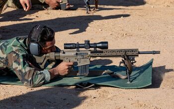
Measurement & Math
One of the most precise ways to measure a distance without a laser involves math, unfortunately. The first step is measuring a known-size object in the units of the scope reticle. For example, a known-size object like a semi truck trailer or deer is measured in MIL or MOA. Because we know the size of that item and know how large an angle it appears to be from our position, with algebra, we can calculate the range to the target. This is simpler with MILs than minutes, but the math looks like this if using MILs, inches, and yards:
Target Size in inches X 27.77 / Target size in MILs = Range
So if the target is 18 inches wide and measures 0.5 MILs across in the scope, the formula would be
18 X 27.77 / 0.5 = 999.7 yards to the target.
This formula can also be flipped around if the range to the target is known but the size of the target is not, but that is beyond the scope of this article.
But we can also shortcut this math by using a reference card, like the ones made by Sobchak Security. These show common items and their measurements, and also have a table showing how many MILs or MOA these items will measure at various distances. So if you measure a fire hydrant at 2.3 MILs tall, the card tells you that it is 400 yards away without doing any math.
The accuracy of this method very much depends on knowing the target size and getting a very accurate measurement through the scope. In the above example, if the same target is measured as 0.4 MIL the distance would be 250 yards of error. Given how much a bullet drops with each passing yard at those extended ranges, this would surely result in a miss off target.

Passive Tools
These next methods are a step down in accuracy from measurements, but can still give decent results on the fly. First up are passive tools. These are devices that the user looks through and aligns with an object to give an estimated range. Current examples of this are tools like the Range R card. The card must be held at a specific distance from the user’s eye, and there can be an error at longer ranges because the size differences are less pronounced.
This is not a new idea, though. Back in the days of battleships, coincidence rangefinders provided ranges using triangulation. These were wide tubes with various mirrors and lenses, and they fell out of use as electronic methods became available. There were also tools like the Musketry Rule of 1918, which was a small slide rule used to calculate ranges in World War 1.
Some riflescopes have features like this built in. The Primary Arms ACSS reticles feature various ranging components to give a quick-and-dirty range to the target. Many Russian scopes, like the PSO scopes seen on the SVD Dragunov rifles, include lines for estimating range based on the apparent size of a standing soldier.
Landscape Objects
This method requires knowledge of your local area and is very situational. Certain landscapes have recurring features, and knowing those sizes can help with a rough range estimation. For example, city blocks may tend to be a certain size, or farm fields may have an average width or size in some surveying systems. This is not a useful method in all locations; there is a shortage of regularly spaced landscape items in the backcountry, but it can come in handy in certain situations.
Visual Comparisons
Some people find success by taking a known-size item in their mind and superimposing it over the landscape. This is the classic “counting football fields” method. Personally, I don’t spend enough time looking at football fields to use them as a ruler, but this works very well for some.
Visual Signatures
Another trick is learning what level of detail is visible on different objects at different ranges. Here is an example from a US Marine Corps document:
“(1) 100 Yards. At 100 yards/meters, the target can be clearly observed in detail, and facial features can be distinguished.
(2) 200 Yards. At 200 yards/meters, the target can be clearly observed, although there is a loss of facial detail. The color of the skin and equipment is still identifiable.
(3) 300 Yards. At 300 yards/meters, the target has a clear body outline, skin color usually remains accurate, but remaining details are blurred.
(4) 400 Yards. At 400 yards/meters, the body outline is clear, but remaining detail is blurred.
(5) 500 Yards. At 500 yards/meters, the body shape begins to taper at the ends. The head becomes indistinct from the shoulders.
(6) 600 Yards. At 600 yards/meters, the body appears wedge-shaped with the appearance of no head.”
This also works with other objects with enough practice. Learning what common items around you look like at longer ranges can give you a decent guess. This can be anything from train cars to pickup trucks to cows or porta-johns.
Pacing
This method assumes you can easily walk from the firing position to the target, which may not always be the case. In order to get an accurate pace measurement, you need to measure it as an average over a distance, like 100 feet or yards. Divide the total distance by the number of NORMAL steps that you took, and that will give you a pace measurement. Measuring one single step is a good way to get bad data.
Maps
Another technique uses a map scale to give a rough target range. On a paper map, if the resolution is fine enough and the target is near a sufficiently obvious landscape item, measuring using the scale of the map can give a rough target distance. The accuracy of this method will depend very much on the quality of the map and the accuracy of the firing and target points on the map, but it can give a general idea if nothing else is available.
A more accurate method is to use the measurement features in a navigation app. I use OnX maps while hunting, and have used the distance measurement tool to get a ballpark range number on a target. This is more accurate than a paper map because it has an accurate location fix for the user. Drawing a line to the target location based on things like ridgelines, trails, or treelines can give decently accurate information.

SWAG
The “Scientific Wild A** Guess” or SWAG is a time-honored tradition. Sometimes, there is nothing better to go on than just your best guess. With practice, you can look at a target and say “that looks like 400 yards” with some level of confidence. This is not scientific, and it is easy to get it wrong, but when nothing else works you have to go with your gut.
Remember how earlier we said that a laser rangefinder was no substitute for learning to read yardages? That is still true. But a laser rangefinder is one of the best ways to learn how to visually estimate them. Often when I'm out hunting or shooting long-range, we will play “guess the yardage.” The goal of this game is to guess closest to what the laser rangefinder readout will be.
The most common reason that someone makes a major range guessing error is the presence of “dead ground” between the shooter and the target. Things look a lot closer than they are when part of the intervening distance is blocked from view. For example, if a hill gets in the way and you cannot see how much ground is in between you and the target, it is very easy to underestimate the distance. This picture is an example of this phenomenon. We can tell that the lake in the picture is some distance away, but that hill blocks the view of the ground leading to the lake. So, how far away do you think the furthest edge of the lake on the left is? Make your guess before scrolling down.

The approximate distance to the far end of the lake is… 860 yards! That’s hard to tell from a picture, so don’t beat yourself up if your guess was bad. Remember to include the dead ground when you are guessing ranges out in the field!
Conclusion
Distance to the target is a key piece of information if you want to hit the target. Depending on where you are and what tools are at your disposal, there are many ways to figure it out, or at least take a decent guess. All of these methods take practice so start putting in reps if you want to sharpen your skills.

AKA @fromtheguncounter on Instagram. Gun nerd, reloader, attorney, and mediocre hunter.
More by Daniel Y


![[SHOT 2025] Magpul’s New Releases](https://cdn-fastly.thefirearmblog.com/media/2025/01/24/17441/shot-2025-magpuls-new-releases.jpg?size=350x220)


![[SHOT 2025] RCBS Launches New Matchmaster Powder Funnel System](https://cdn-fastly.thefirearmblog.com/media/2025/01/23/01161/shot-2025-rcbs-launches-new-matchmaster-powder-funnel-system.jpg?size=350x220)


![[SHOT 2025] Shield Sights Introduce Clear Hood Pistol Red Dot - OMSsc](https://cdn-fastly.thefirearmblog.com/media/2025/01/23/13131/shot-2025-shield-sights-introduce-clear-hood-pistol-red-dot-omssc.jpg?size=350x220)


Comments
Join the conversation
I’m probably more pleased with myself than I should be for getting a close-ish range estimate of that lake’s far edge (900 yards).
Big deal. In 1970 I had a laser rangefinder that would give the distance out to 30 clicks! Course was military. As a Marine FO, I was assigned to lead a team of experienced forward observers in using a new device, the IOD, Integrated Observation Device. Combined the laser, a medium NOD, and a pair of 10/20 power Kellmorgan ships binoculars. All mounted on a heavy tripod and included large batteries. All told 330# of gear…definitely not packable. We were set out on hills surrounding free fire zones. Payback for all those times we were ambushed and I couldn’t get clearance for fire.